Remote Sensing of Lake Shrinkage Under Drought
Temporal satellite comparison of drying lakes in an ArcGIS StoryMap
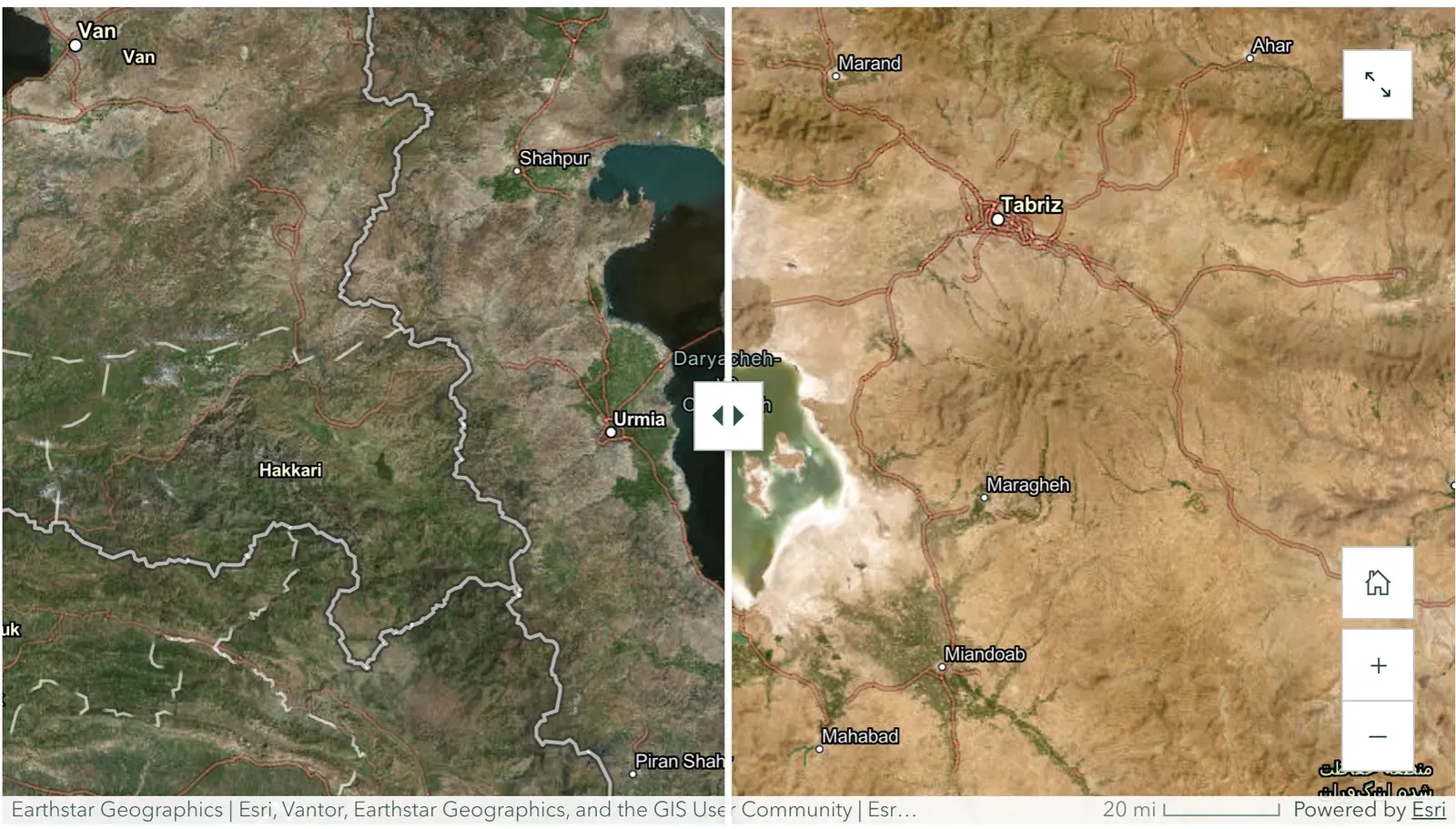
Side-by-side satellite imagery documented severe shrinkage at lakes worldwide, including Lake Urmia receding to about 10 percent of its original size and Lake Poopó drying almost completely as its evaporation roughly tripled since the 1990s.
Result
Before-and-after satellite imagery showed how far several major lakes have fallen under sustained drought and warming. Lake Urmia in Iran has receded to about 10 percent of its original size. Lake Poopó in Bolivia, shallow and high in the Andes, has all but dried out as its evaporation rate roughly tripled since the 1990s.
Objective
The aim was to make lake loss visible rather than abstract. Numbers about falling water levels are easy to skim past, so I built an ArcGIS StoryMap that puts dated satellite images side by side and lets the imagery carry the change.
Approach
Each lake is presented as a temporal comparison using ArcGIS swipe and image-comparison maps built on Earthstar Geographics and Maxar satellite imagery. Lakes were chosen specifically where drought is a significant contributing factor, not ordinary seasonal rise and fall or simple drainage for irrigation. For each site, the narrative pairs the imagery with the physical drivers: dammed rivers, groundwater pumping, and diversions at Lake Urmia, and shrinking Andean glaciers plus high-altitude evaporation at Lake Poopó. The Great Salt Lake is included as a third case (2019 versus 2023).
Findings
The Lake Urmia swipe is the clearest single result. The left panel shows a broad water body; the right shows it collapsed to pale salt flats, consistent with the reported loss to roughly a tenth of its former extent. The Lake Poopó pair is even more stark. The earlier image holds a visible lake near Oruro; the later image is mostly exposed salt pan. Because the lake averages only about 10 feet deep and sits above 12,000 feet, small increases in temperature translate into large losses of surface water.
Why it matters
These lakes are not just scenery. Lake Urmia’s marshes support over 200 species of birds, and Lake Poopó sustained fishing communities until the water left. Reading the change straight off the satellite record shows how drought and warming combine to remove water that people, plants, and animals depend on, and it does so in a format anyone can see at a glance.